
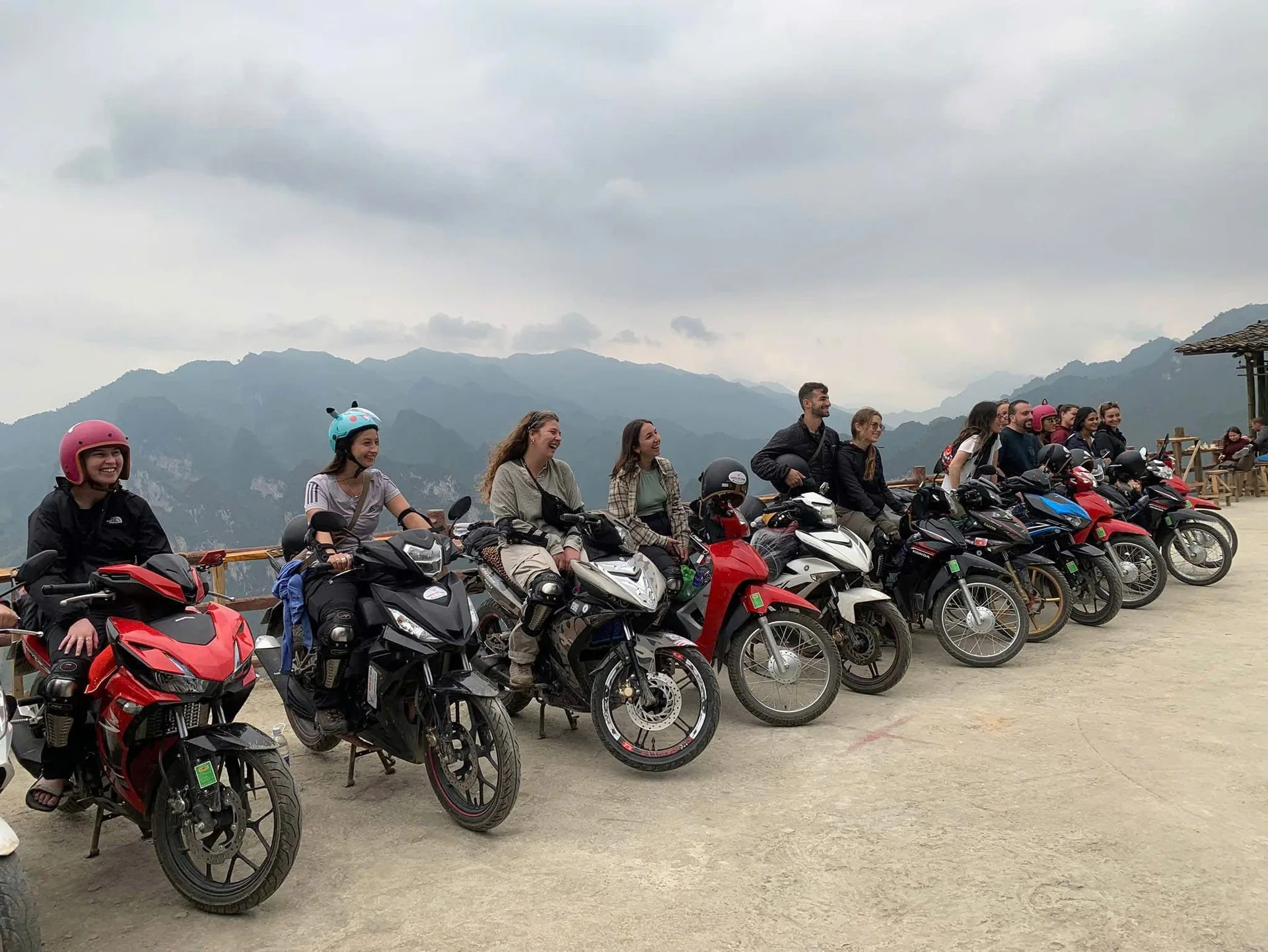
10 Aug 2026
Ha Giang Loop Adventures: A Complete Guide to Riding Northern Vietnam
Ha Giang LoopTravel guideDong Van Karst PlateauMa Pi Leng PassEasy Rider
Ask anyone who has ridden the Ha Giang Loop what they remember and they rarely start with a kilometre count. They talk about a cliff road hanging over a jade-green river, a bowl of pho in a market town at dawn, a grandmother in a H'mong village waving them off. The Loop is a motorbike circuit through the far north of Vietnam, hard against the Chinese border, and one of the great road journeys of Southeast Asia.
We are Freedom, a small local team based in Ha Giang city, and we ride these roads every week. This guide is what we say at our briefing table: how the route works, what the Dong Van Karst Plateau is, what the weather does, who lives along the road, how long to take, and whether to ride yourself or sit behind an Easy Rider.
Ha Giang Loop quick facts
- Where: Far northern Vietnam, on the border with China. Ha Giang city is the start and finish, an overnight bus from Hanoi.
- Length: Roughly 300 to 350 km. Our Loops run 2, 3 or 4 days.
- Terrain: Limestone karst mountains, deep canyons and passes well above a thousand metres.
- UNESCO: The Dong Van Karst Plateau, Vietnam's first UNESCO Global Geopark.
- Signature road: Ma Pi Leng Pass above the Nho Que River and Tu San canyon.
- Who lives here: H'mong, Tay, Dao, Lo Lo, Giay, Nung and other ethnic groups.
- Ways to ride: Easy Rider, ride yourself with a valid licence, or the seat behind a friend who rides.
Why the Loop feels different from other road trips
Most road trips are a line between places. The Loop is a circle, and the circle is the destination. Leave Ha Giang city on the river flats and within an hour you are climbing Bac Sum Pass into cooler air; an hour later the forest thins and the ground turns to grey stone; by the second afternoon you are looking down several hundred metres at a river the colour of jade. What makes it stick, though, is that the landscape is lived in. Corn grows between the rocks on every slope, hand-built stone walls mark out fields the size of a living room, children walk to school along the verge. The mountains give the scale; the people give the meaning. The moment guests tell us about afterwards is rarely a viewpoint. It is a cup of corn wine from a homestay host, or a farmer who helped push a bike out of the mud.
The classic route, the Freedom way
The standard Loop runs clockwise through Quan Ba, Yen Minh, Dong Van and Meo Vac. We ride it the other way, starting on the quiet southern road through Du Gia, because it saves the biggest views for when you are warmed up and gives you two very different homestays. Our most popular 3-day itinerary:
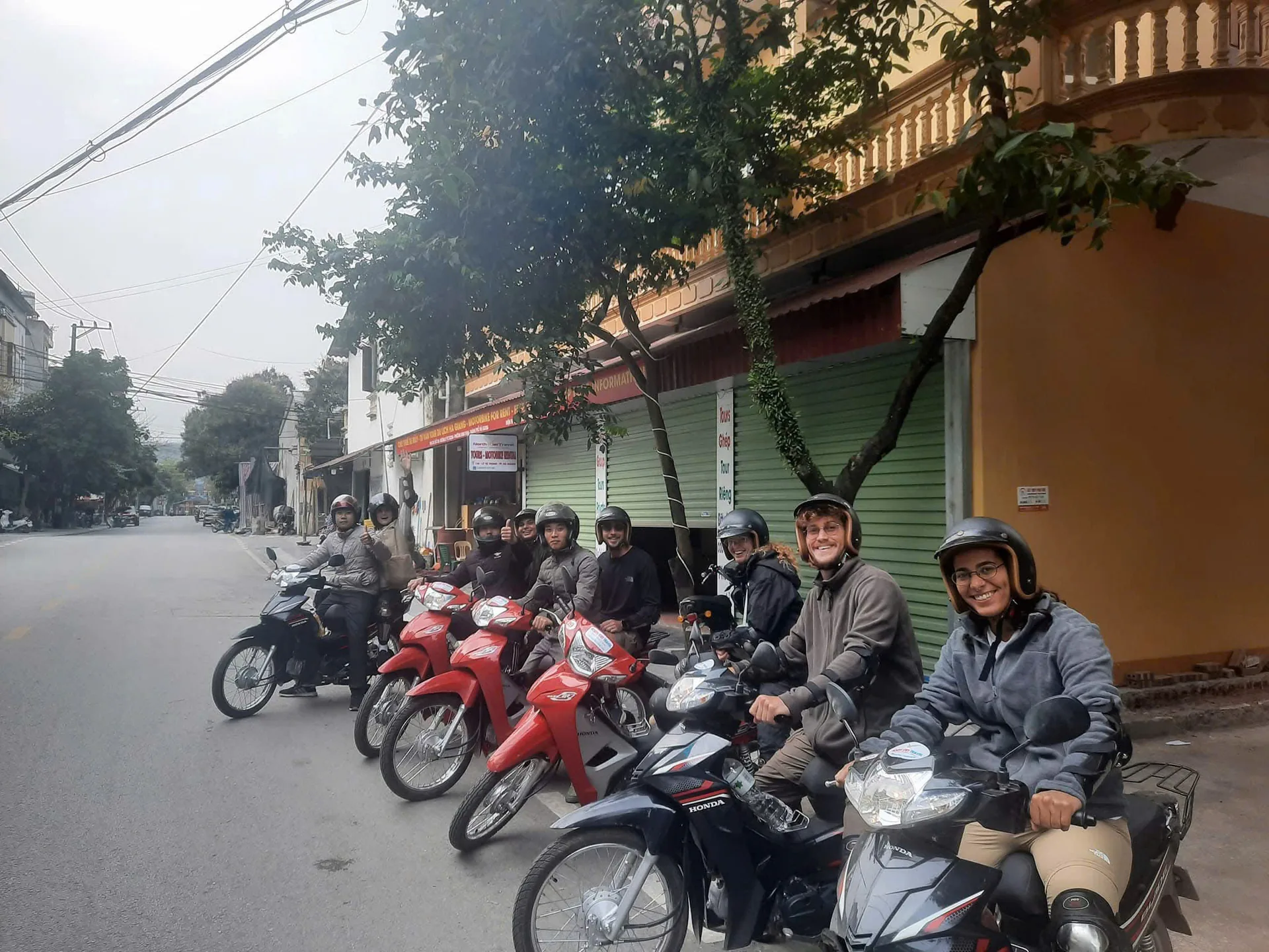
Day 1: Ha Giang to Du Gia. The back road through Ban Cuong and Thuan Hoa follows the river past bamboo and paddies, and by mid-morning we are swimming under A Boong waterfall. After lunch in Thai An the road lifts into the Duong Thuong and Lung Ho valleys, wide bowls of rice and corn hemmed in by limestone. The night is with a Tay family in Du Gia, in a wooden stilt house, with dinner cooked at home.
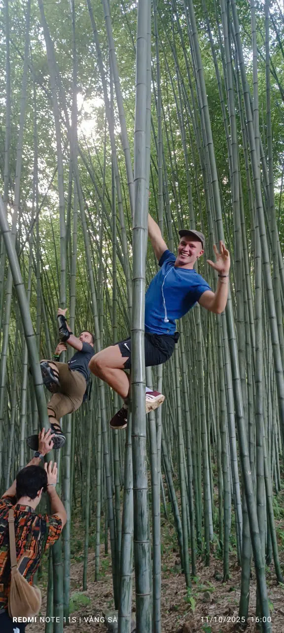
Day 2: Du Gia to Dong Van. Morning belongs to the water: local fishermen pole us down the Hangtham Lin River on bamboo rafts. From Sung Trai the road climbs to the Meo Vac viewpoint and through a bamboo forest to the main event, the Nho Que River far below and Ma Pi Leng Pass cut into the cliff. We take it slowly and stop wherever the light is good. The night is with a H'mong family in Dong Van.
Day 3: Dong Van to Ha Giang. The viewpoint over the Chinese border, the stone lanes of Thien Huong and the karst field locals call the Moon Surface, then the hairpins of Tham Ma Pass down to lunch in Yen Minh. The afternoon runs the classic northern road in reverse: Lao Va Chai, Can Ty, the Twin Mountains of Quan Ba, Heaven Gate and Bac Sum Pass, back in the city in time for the night bus.
Our 4-day Loop adds a full day for Lung Cu flag tower, Lo Lo Chai village and the century-old Lao Xa house, with a third night in Yen Minh, and finishes with Lung Khuy cave and the hemp weavers of Lung Tam.
Dong Van Karst Plateau: mountains written in stone
Almost everything north of Quan Ba sits inside the Dong Van Karst Plateau Geopark, which covers the highland districts of Quan Ba, Yen Minh, Dong Van and Meo Vac. It was the first place in Vietnam to receive UNESCO Global Geopark status, which is not the same as a World Heritage Site: the label recognises the geology, and the people who live on it as part of the story.
The plateau is mostly limestone, laid down as sea floor hundreds of millions of years ago and then lifted, folded and slowly dissolved by water. That is why the rock around Dong Van looks like a frozen grey sea and the ground is riddled with sinkholes, caves and gorges. The fossils in these hills, corals, trilobites and ancient fish among them, record a time when this was ocean. Please leave them where they are. Taking rock or fossils out of the geopark is illegal, and a genuine loss.
Ma Pi Leng, the Nho Que River and Tu San canyon
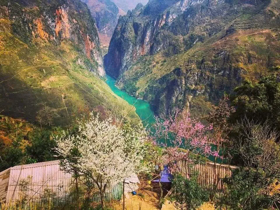
Ma Pi Leng is the pass everybody has seen a photo of, and it lives up to it. The road clings to the mountainside for about twenty kilometres between Dong Van and Meo Vac, part of the "Happiness Road" that work crews from the local ethnic communities cut through the rock by hand in the middle of the last century.
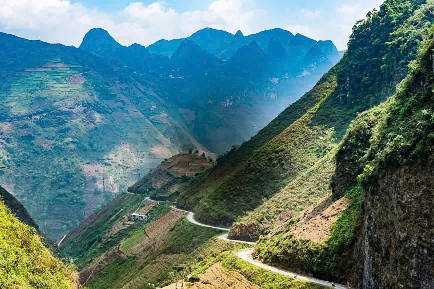
Below runs the Nho Que River, a thread of milky green at the bottom of Tu San canyon, whose walls drop several hundred metres and rank among the deepest in Southeast Asia. The roadside view is the classic one, but go down to the water too: boats run through the gorge, and from below, the road you rode an hour earlier is a scratch on the cliff. The two views explain each other. On the descent to Meo Vac, the M-shaped slope is where every rider pulls over.
Culture beyond the viewpoints
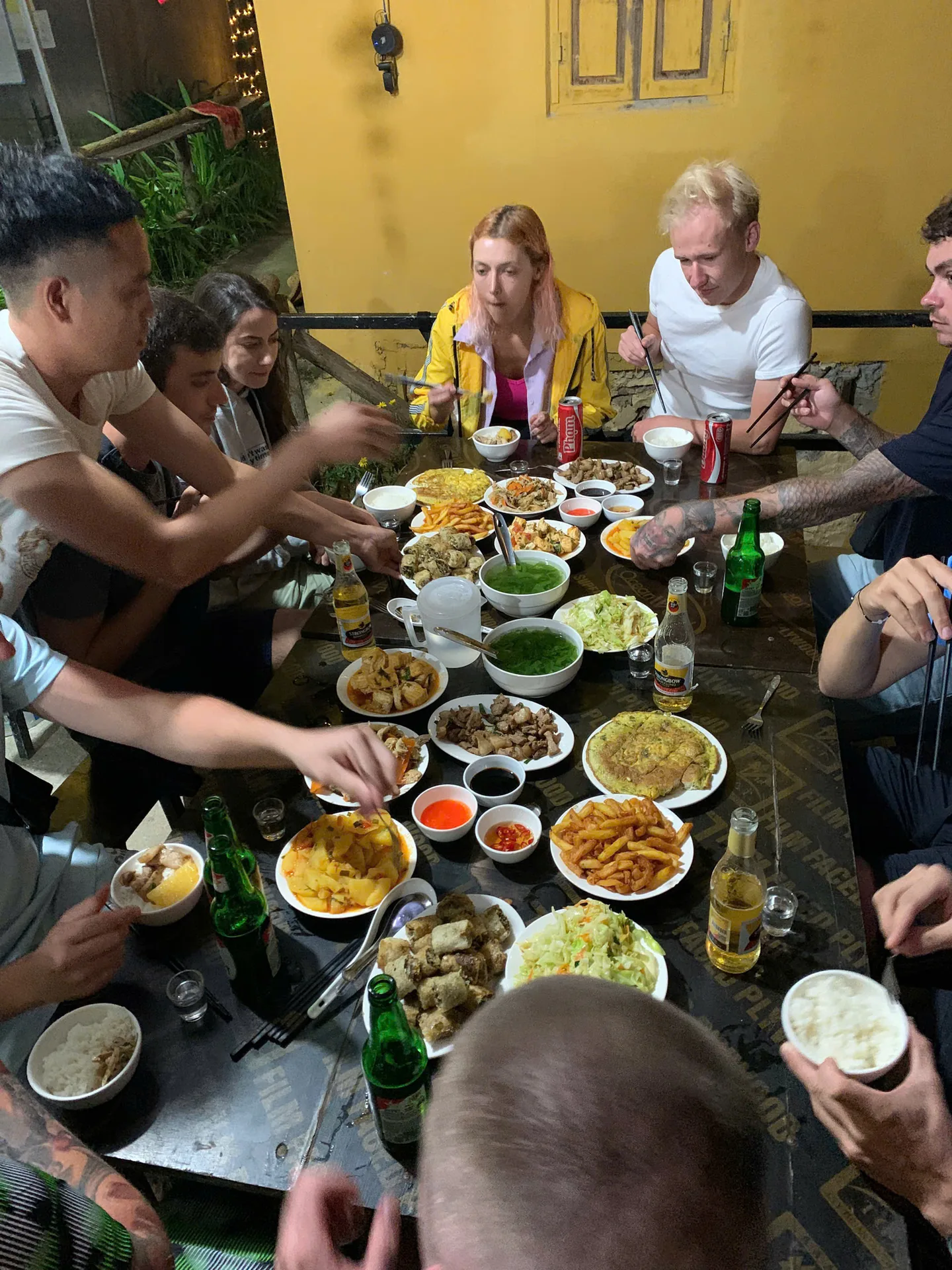
The plateau is a patchwork of ethnic groups. The H'mong are the largest, and their stone-walled houses with clay-tile roofs are everywhere north of Yen Minh. The Tay live lower down in the river valleys around Du Gia, in wooden stilt houses. The Lo Lo have their village at Lo Lo Chai under the Lung Cu flag tower, and Dao, Giay, Nung, Co Lao and Pu Peo communities are scattered through the hills, each with its own dress, language and way of farming. You see this most vividly at the Sunday markets in Dong Van and Meo Vac, where people walk for hours from surrounding hamlets to trade, eat and meet, and at Lung Tam, where H'mong women spin, weave and indigo-dye hemp cloth.
A few things we ask of every guest. Ask before you photograph someone, and accept a no. Do not walk into a house uninvited; you will be invited often enough. Traditional clothes are not costumes for a selfie. Buy textiles, honey and corn wine from the people who made them. A village is not a viewpoint; it is someone's kitchen, yard and field.
Two, three or four days?
We run all three. Two days (Easy Rider only) goes straight over Bac Sum, Tham Ma and Ma Pi Leng with a night in Dong Van: fast, spectacular and around 310 km of long riding, for people with a tight itinerary who do not mind full days in the saddle.
Three days is what most guests choose and what we recommend. It adds the waterfall, the rafting and the Tay homestay, so you get a day about water and villages before the day about cliffs.
Four days changes the pace rather than the distance. The extra day goes north to Lung Cu, the northernmost point of Vietnam, and to Lo Lo Chai and Lao Xa. Mountains do not run on schedules: fog rolls in, a shower closes a road for an hour, a viewpoint deserves another twenty minutes. With four days none of that is a problem.
Weather by season
Ha Giang has real seasons, and they change the ride.
- September to November: the dry, golden window. Clear skies, cool mornings, rice harvest and, in October and November, pink and white buckwheat flowers across the plateau. Also the busiest time.
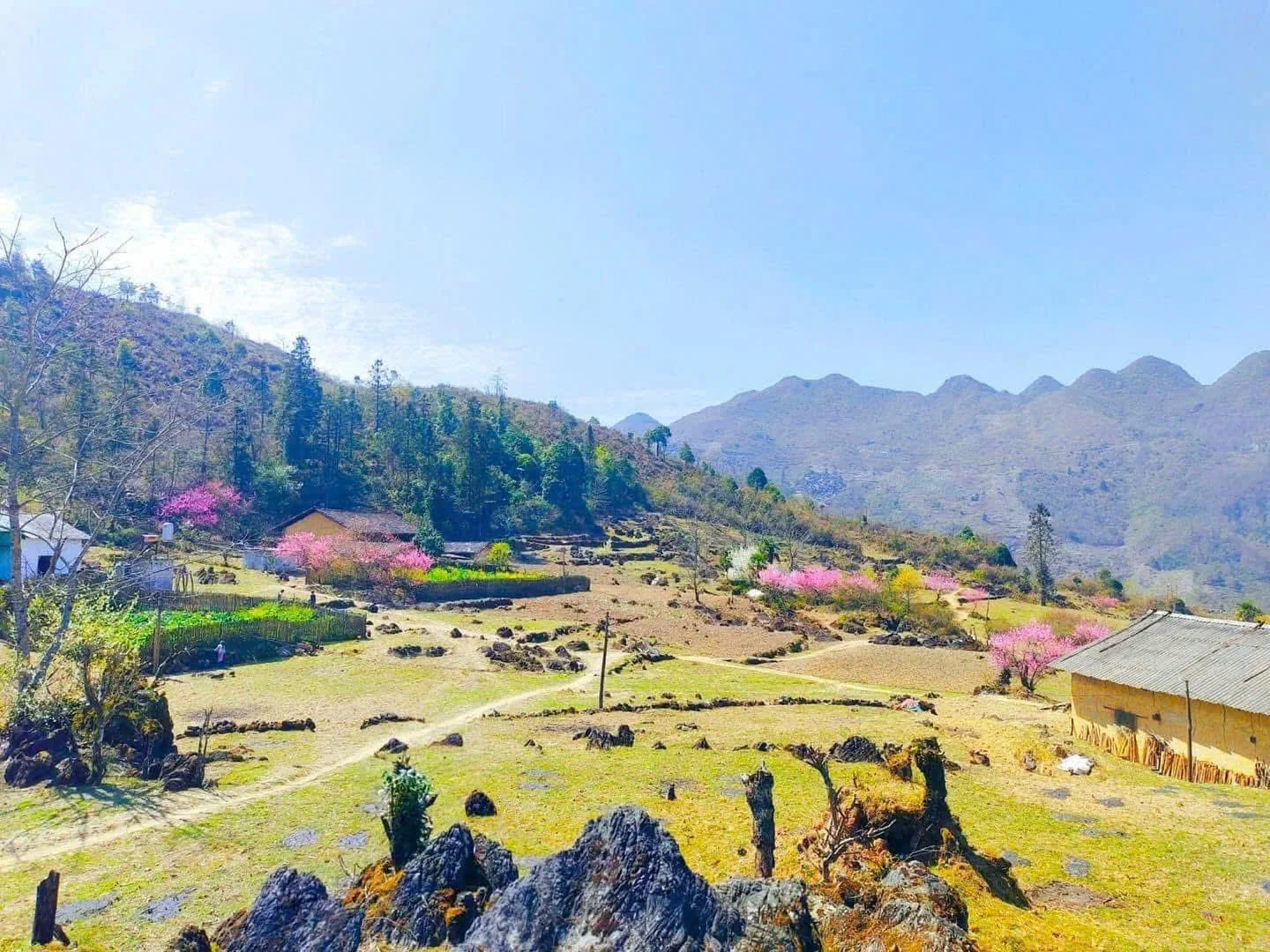
- December to February: cold. Temperatures on the plateau can fall close to freezing and fog sits on the passes, so bring proper layers. The roads are quiet, and late February brings plum and peach blossom around Dong Van.
- March to May: mild and green, with rice going into the terraces. A good all-round time.
- June to August: hot and wet. Afternoon storms can be heavy and a landslide occasionally closes a road, so we plan each day around the rain. The valleys are at their greenest and the waterfalls at their fullest.
Easy Rider, ride yourself, or seat behind a friend?
This is the decision that shapes your Loop, and we are honest about it.

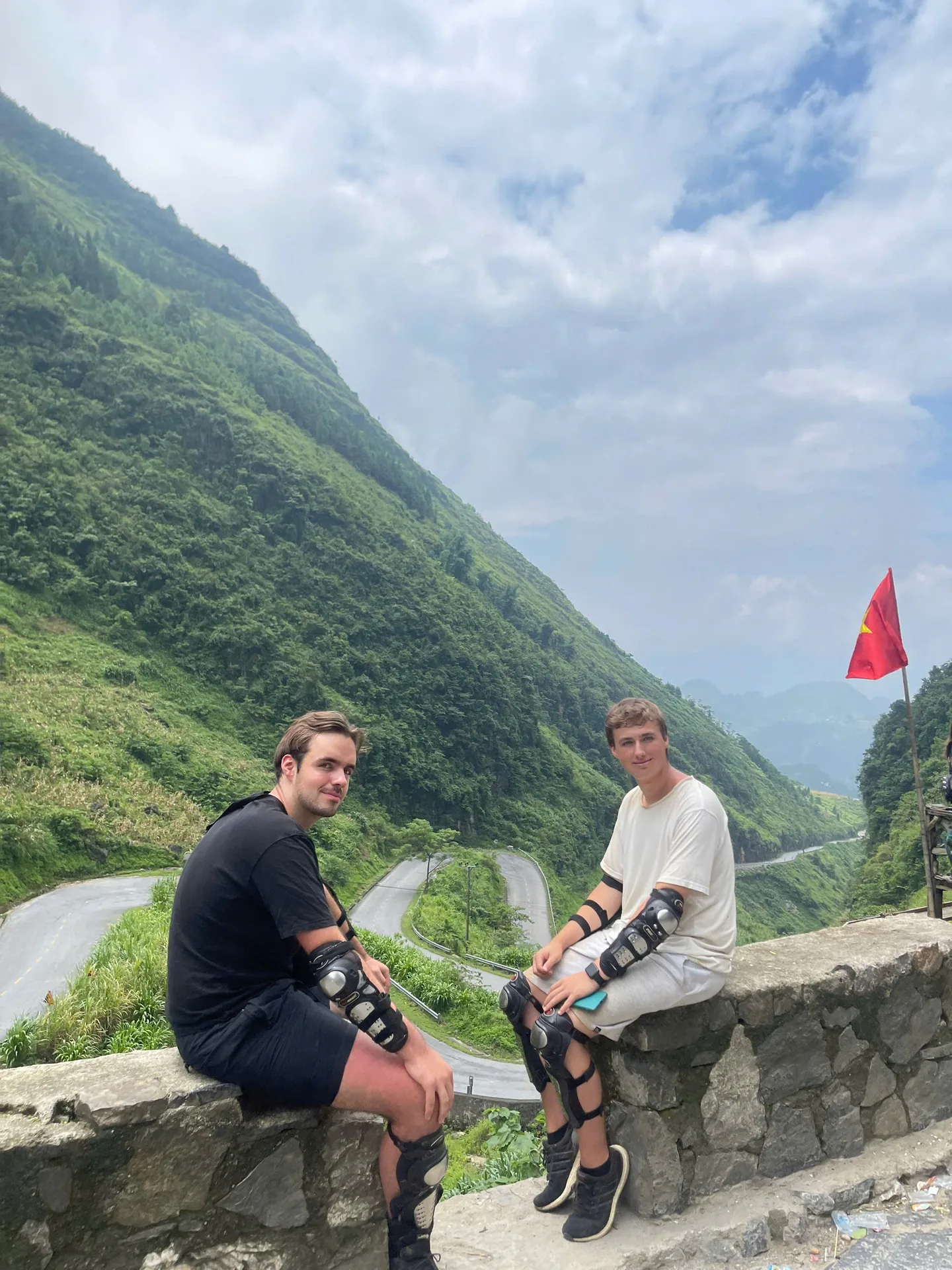
Easy Rider. You sit behind one of our local drivers, who has ridden these passes for years, and your only job is to look. No licence, no riding experience, no stress on wet hairpins. It is the right choice for most first-time visitors and, frankly, for anyone who wants to spend Ma Pi Leng watching the canyon instead of the road. Available on every Loop: 3.800.000₫ for 2 days, 4.700.000₫ for 3 days, 5.700.000₫ for 4 days.
Ride yourself. If you are a genuine motorbike rider, riding your own bike inside our guided group is a joy. The law comes first: to ride legally in Vietnam you need an International Driving Permit issued under the 1968 convention with a motorcycle category (A or A1), carried with your national licence. Police on the Loop check both, and without them your insurance will not cover you. Then be honest about skill. Ma Pi Leng is not the hard part; gravel patches, wet concrete after a shower, a bus on your side of a blind bend and tiredness on the third afternoon are. Self-riding is 3.750.000₫ for 3 days and 4.550.000₫ for 4 days.
Seat behind a friend. Travelling with someone who holds the licence and wants to ride? Share their bike and pay only the seat-behind price: 3.050.000₫ for 3 days, 3.850.000₫ for 4 days.
Whichever seat you choose, the same things are included: pick-up from Hanoi, Sapa, Ninh Binh, Cat Ba or Ha Long, a dorm bed at our Ha Giang base the night before, an English-speaking guide in every group, bike and fuel, three meals a day, helmet, protective gear and rain coat, entry tickets, travel insurance and luggage storage. We keep groups small so every stop is unhurried and nobody is left at the back.
Safety and responsible travel
We would rather you went home with a slightly shorter story than a longer one told from a hospital bed. Our rules, whether you ride or ride pillion:
- Helmet on and strapped, every time. Closed shoes, long trousers, rain jacket within reach.
- Slow down before the bend, not in it. Never stop on a blind corner for a photo; there is a better spot fifty metres on.
- Daylight only. Every day is planned to be off the road before dark.
- If fog comes down or rain turns serious, we wait or change the route. A changed itinerary is normal mountain travel, not a failure.
- Corn wine comes after the bike is parked for the night.
Beyond the bike: carry rubbish off the viewpoints, stay out of crops, leave rocks and fossils in the geopark, ask before photographing people and spend your money with the families who live here. You are borrowing this road for a few days. For them it is the way to school and to market.
A last word before you ride
The Ha Giang Loop is geology, culture and a road, all at once. You will photograph Ma Pi Leng the most and remember the Nho Que River the longest, but the moments that stay may be smaller: a morning above a sea of cloud, a Tay grandmother refilling your bowl, a guide pointing at the mountain his grandfather farmed. Take your time, choose the seat that matches your experience, and let the road do the rest.
Frequently asked questions
How many days do I need? Two is the minimum and a sprint. Three covers the highlights with the waterfall and rafting. Four adds Lung Cu and a slower pace.
Should beginners ride themselves? No. If you have not ridden a manual or semi-automatic motorbike on mountain roads, sit behind an Easy Rider. You will see more and be safer.
Is the Dong Van Karst Plateau a World Heritage Site? No. It is a UNESCO Global Geopark, a separate designation for landscapes of geological importance.
When is the best time to go? September to November for clear weather and buckwheat flowers, March to May for mild green days. Winter is cold and foggy but quiet; summer is lush but wet.
Do I need a licence to ride myself? Yes: a 1968-convention International Driving Permit with category A or A1, plus your home licence. Without both, book Easy Rider.
Ready to ride?
Compare our 2, 3 and 4-day Loops, with Easy Rider, self-riding and seat-behind prices, on our pricing page. For questions about dates, licences or pick-up from Hanoi, message us on WhatsApp at +84 973 910 970 and a real person from the Ha Giang team will reply.
More stories
10 Aug 2026
Freedom Ha Giang Loop: Why Ride Vietnam's Mountain Road With Us
What a Ha Giang Loop with Freedom actually looks like: three ways to ride, small groups with their own guide, family homestays, proper gear, pick-up from Hanoi and a safety-first pace.
Read more →
10 Aug 2026
Ha Giang Loop Deaths: The Safety Facts to Know Before You Ride
People do die on the Ha Giang Loop, and pretending otherwise helps nobody. Here is what actually goes wrong on these mountain roads, what the licence law says, and how to pick a way of riding that brings you home.
Read more →10 Aug 2026
The Ha Giang Loop Road: Conditions, Safety and Why This Mountain Road Teaches You to Travel Slowly
What the Ha Giang Loop road is really like: surfaces, weather, blind corners, the people who live beside it, and why the road itself ends up being the best guide you have.
Read more →